Log in
All resources
Create a design
49 Free Artworks of Travel Maps Of Asia
maps of marco polo's travels
maps indicating exploration
exploration of asia
maps of journeys
maps of xuanzang's travels
realism
maps from the earth and its inhabitants, vol. vi
bibliothèque nationale de france
william hogarth
abdul mejid (explorer)
1876 maps
1884 maps
1876 maps
1884 maps
maps from the earth and its inhabitants, vol. vi
maps of the silk road
maps from the earth and its inhabitants, vol. vi
exploration of asia
maps from the earth and its inhabitants, vol. vi
exploration of asia
maps from the earth and its inhabitants, vol. vi
charles eugène perron
maps indicating exploration
pamir mountains
maps indicating exploration
pamir mountains
maps from the earth and its inhabitants, vol. vii
maps indicating exploration
maps indicating exploration
pamir mountains
19th-century maps of china
richard jarman
my early travels and adventures in america and asia (1895)
everett d. graff collection of western americana
illustrations from césar cascabel by george roux
1890s maps of asia
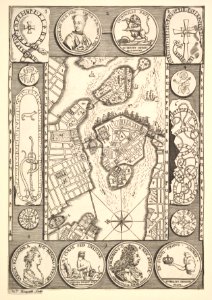
18th-century maps of stockholm
realism
van langren map of southeast asia
1595 maps of asia
maps by jodocus hondius
old maps of virginia
hendrik van langren map of south asia
1595 maps of asia
hendrik van langren map of south asia
1595 maps of asia
maps of novaya zemlya
1590s maps
english-language maps
1747 maps of asia
a.de la motraye's travels through europe, asia, and into part of africa (1723) by la mottraye
realism
1840s maps showing history
maps by thomas starling
1770s maps of alaska
robert de vaugondy
maps by thomas starling
1842 maps
select views in india, drawn on the spot, in the years 1780, 1781, 1782, and 1783
british library asia, pacific and africa collections
maps of saint paul's journeys
maps by thomas starling
maps from the earth and its inhabitants, vol. ix
maps indicating exploration
a.de la motraye's travels through europe, asia, and into part of africa (1723) by la mottraye
realism
voyages and travels to india, ceylon, the red sea, abyssinia, and egypt
blank back covers of books
19th-century maps of the malay archipelago
the cruise of the marchesa (1889)
a.de la motraye's travels through europe, asia, and into part of africa (1723) by la mottraye
realism
sanson maps of the holy land
old maps of canaan
1825 maps of asia
tranquillo mollo
1600 maps of africa
benjamin wright
maps by girolamo ruscelli
maps by girolamo porro
mappe-monde geo-hydrographique (sanson and jaillot, 1674)
cartography of france
navigantium atque itinerantium bibliotheca
1744 fleurons
maps by emanuel bowen
1744 fleurons
prints by william hogarth in the british museum
realism
maps by emanuel bowen
1744 fleurons
prints by william hogarth in the british museum
realism
prints by william hogarth in the british museum
realism
navigantium atque itinerantium bibliotheca
1744 fleurons
prints by william hogarth in the british museum
realism
mappe-monde geo-hydrographique (sanson and jaillot, 1674)
prints by william hogarth in the british museum
realism
prints by william hogarth in the british museum
realism
navigantium atque itinerantium bibliotheca
1744 fleurons
german renaissance
1744 fleurons
1 - 49 of 49
/ 1